Bringing indoor and outdoor navigation together
A single map for your entire site, without relying on hardware

Most wayfinding solutions force a tradeoff between indoor and outdoor navigation.
GPS works well outdoors, but doesn’t perform reliably inside buildings. Indoor positioning systems like Bluetooth beacons can improve accuracy, but require hardware, setup, and ongoing maintenance.
This often leads to uneven experiences. Indoor navigation may be detailed and structured, while outdoor areas are simplified. In other cases, outdoor maps are strong, but indoor environments lack the structure needed to support multi-level navigation or meaningful content.
Pladia has introduced a new approach to wayfinding that connects indoor and outdoor navigation within a single system.
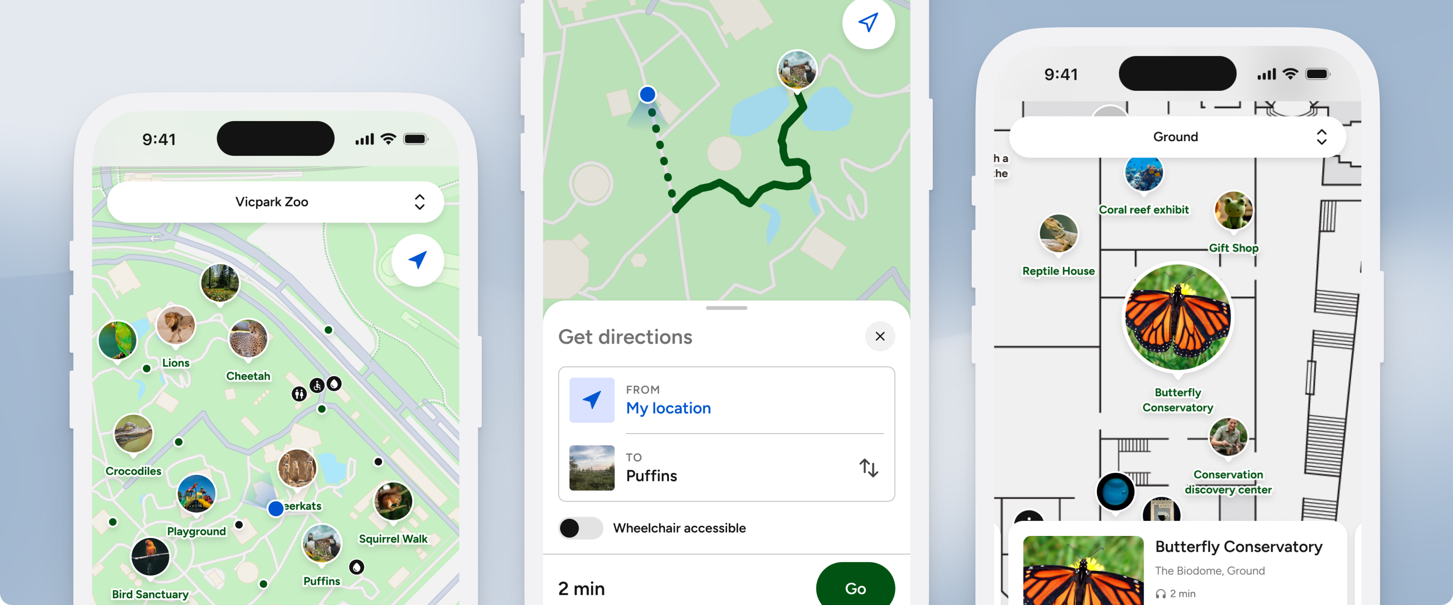
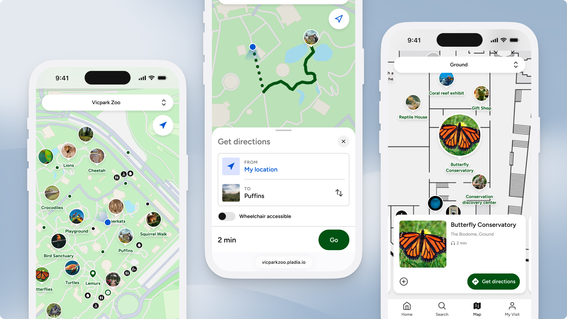
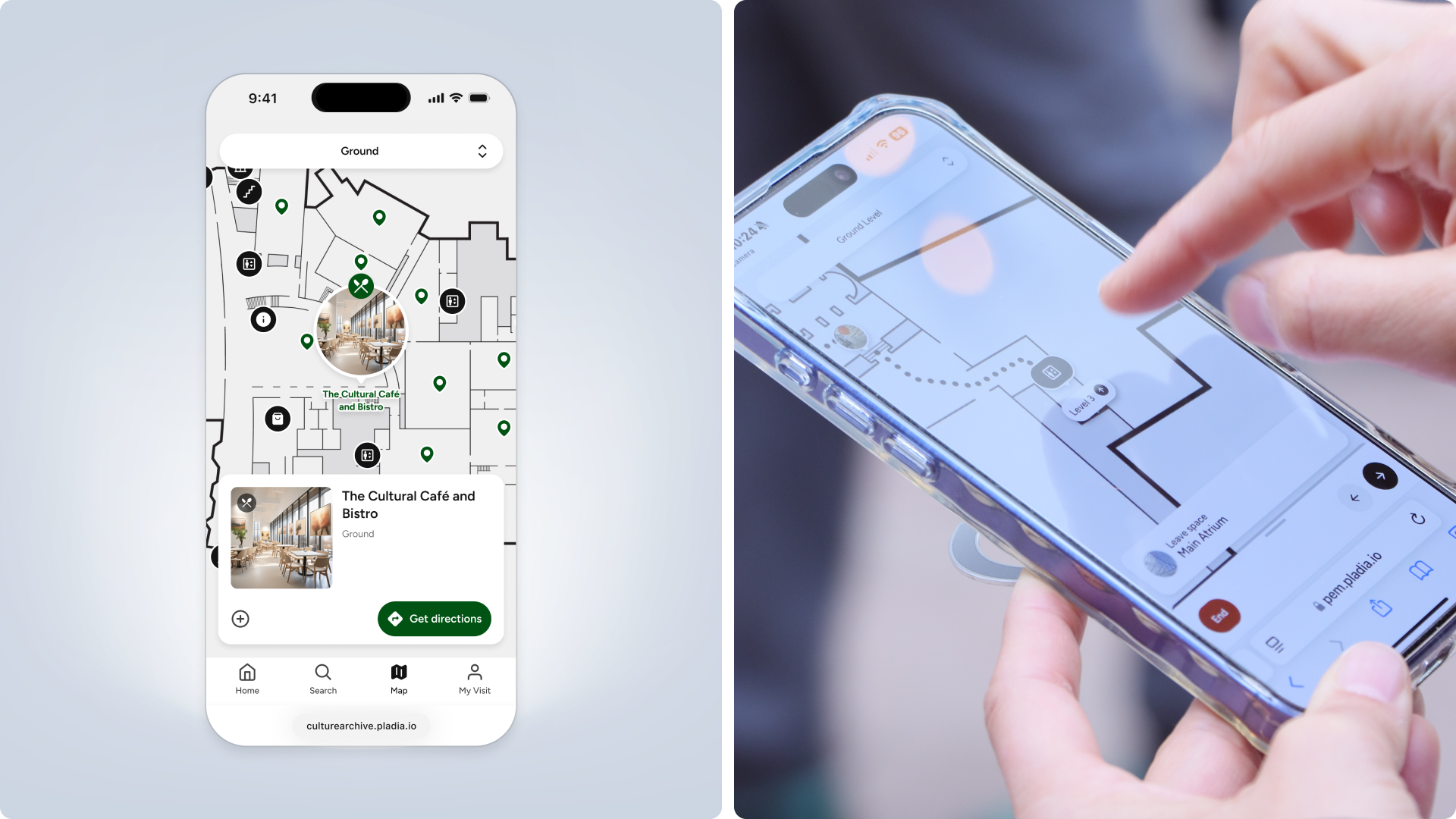
The capability is delivered through Pladia Empower, a browser-based digital experience designed for cultural institutions, zoos, campuses, and precincts. Visitors access Empower through a simple link, allowing them to navigate your site and explore rich, location-based content without downloading an app.
Empower’s interactive map represents your full site in one place, combining buildings, spaces, paths, and the content within them. As visitors move through your site, the map surfaces relevant information tied to their location, such as exhibitions, artworks, events, and amenities.
Pathways: navigation without hardware
Rather than relying on live indoor positioning systems, Pladia’s patent-pending navigation model, Pathways, generates routes from the structure of your site itself. In the Pladia Console, organisations define how spaces connect, including rooms, corridors, vertical connections, landmarks, and outdoor paths.
Routes follow the most efficient path through your environment, with support for different routing needs such as wheelchair-accessible paths. Directions are presented using real parts of your site, guiding visitors through spaces, past key objects, and between levels in a way that feels intuitive.
In outdoor environments, where spaces are larger and more open, visitors can see their live position and orient themselves using surrounding context. The map reflects street-level detail and geographic features such as green spaces and bodies of water.
A single map across your full site
Instead of treating indoor and outdoor navigation as separate problems, organisations can manage their entire site within a single system. Floor plans and outdoor maps sit alongside each other, connected through the same structure.
In practice, this makes it easier to guide visitors across the full venue. A route might begin in a gallery, continue through a sculpture garden, and end in another building, without the visitor needing to switch context or tools.
It also creates more opportunities to surface content in context. Navigation is no longer just about getting from one point to another, it becomes a way to introduce what’s around a visitor and support decisions in the moment.
Rather than optimising for indoor or outdoor navigation in isolation, this approach focuses on the visit as a whole.